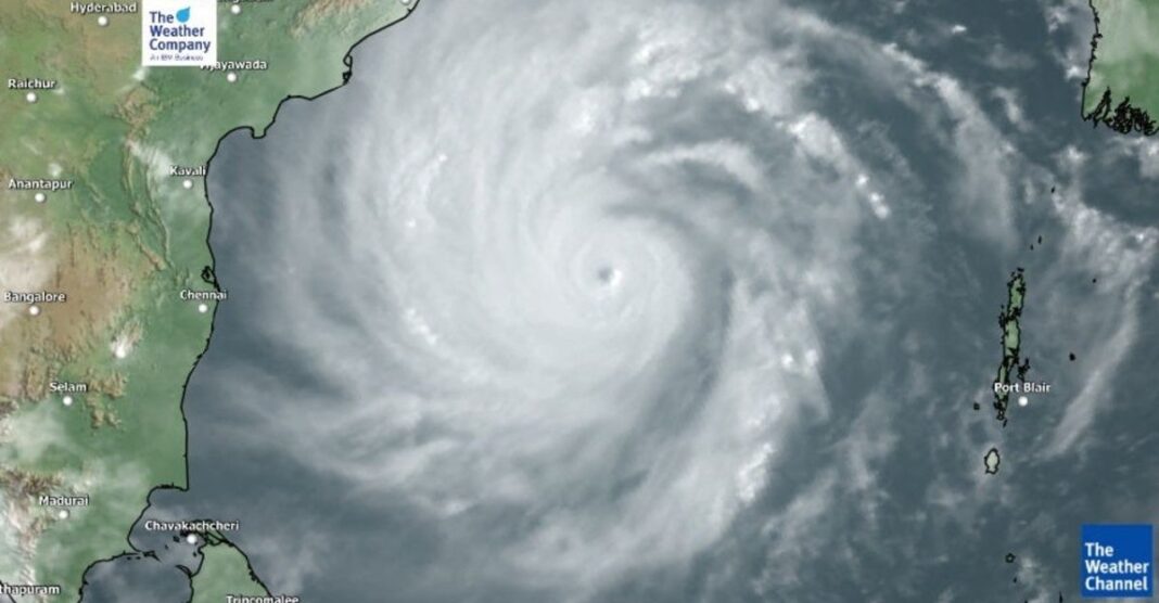
In a developing weather emergency, Cyclone Michaung is anticipated to make landfall along the southern Andhra Pradesh coast between Nellore and Machilipatnam on Tuesday, emerging as a severe cyclonic storm. The associated winds are expected to reach speeds ranging between 90-100 km/hr, gusting up to 110 km/hr.
Over the next three days, at least 10 coastal districts spanning Tamil Nadu, Andhra Pradesh, and Odisha are projected to bear the brunt of Cyclone Michaung’s impact. The India Meteorological Department (IMD) has issued a “red” alert, signaling the likelihood of extremely heavy rainfall (200-250 mm in 24 hours) and turbulent weather conditions across Chennai, Thiruvallur, Chengalpattu, Prakasam, Guntur, Krishna, Godavari, Bapatla, and Elur districts of north Tamil Nadu and coastal Andhra Pradesh.
As of the latest observations at 5.30 pm on Sunday, the cyclone originated over the southwest Bay of Bengal, positioning itself 290 km east-southeast of Puducherry, 210 km east-southeast of Chennai, 330 km southeast of Nellore, 440 km south-southeast of Bapatla, and 450 km south-southeast of Machilipatnam.
We are now on WhatsApp click here to join !
The IMD anticipates Cyclone Michaung to reach the west-central Bay of Bengal, off the south Andhra Pradesh and adjoining north Tamil Nadu coasts by Monday forenoon. Authorities and residents in the affected regions are urged to stay vigilant and adhere to safety guidelines as the cyclone approaches.
We are now on WhatsApp click here to join !


